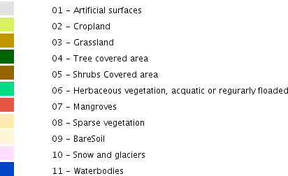
Layers

  • All
  • Visible

Reference maps

  • CARICOM countries
     
    CARICOM countries map legend
  • Global land cover map
     
    Global land cover map map legend

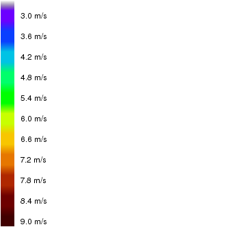
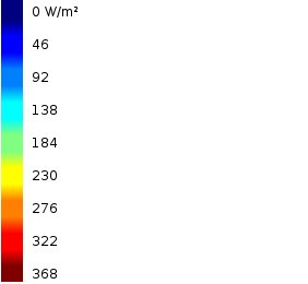
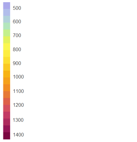
Renewable energy resources

  • Global annual average wind speed at 80 m height (m/s)
     
    Global annual average wind speed at 80 m height (m/s) map legend
  • Global average daily horizontal solar irradiation (W/m²)
     
    Global average daily horizontal solar irradiation (W/m²) map legend
  • Global daily potential photovoltaic electricity production (kWh/kWp)
     
    Global daily potential photovoltaic electricity production (kWh/kWp)  map legend
  • Photovoltaic Power Potential - PVOUT (kWh/kWp)
     
    Photovoltaic Power Potential - PVOUT (kWh/kWp) map legend
  • Global hydropower potential (kW)
     
    Global hydropower potential (kW) map legend

Infrastructures

  • Global power generators
     
    Global power generators map legend
  • Global power sub stations
     
    Global power sub stations map legend
  • Global transformer network
     
    Global transformer network map legend
  • Global power lines
     
    Global power lines map legend
  • Wind power stations
     
    Wind power stations map legend

Energy demand

WMS Services

Base maps

  • Relief
  • OpenStreetMap

Descargas | Téléchargements

  • Reference maps
  • CARICOM countries

Search

Analysis tools

This tool allows showing the values ​​of different variables for the different CARICOM countries or for a polygon drawn by the user. For more information on the use of this tool, you can consult the CCREEE Map Viewer User Manual.

Evolution

Thematic maps

  • Solar energy

  • Wind energy

About the CCREEE MapViewer

The CCREEE Map viewer aims at improving access to data and geographic information about renewable energy services and the energy system in the CARICOM Member States.

All data and geographic information included in the CCREEE Map viewer was provided by international scientific institutions, government ministries, agencies or departments with responsibility for energy within CARICOM countries, and which was supplemented by internet research, author calculations and inferences. Detailed information about the data characteristics is provided at the "Info" section of each resource.

Further details can be found in the ERCs for the individual CARICOM Member States.

Cerrar

Information

The contents of the CCREEE map viewer are being updated. Some geographic information layers are provisional and may undergo changes in the near future.

Cerrar

Information

The CCREEE map viewer shows all layers related to

Cerrar

Cerrar
Load layers